News

The New and Improved Trail Guide

This is very exciting news! History in the making!

The Ganaraska Hiking Trail Association Inc. is extremely pleased to announce the launch of a new Trail Guide that will complement our Ondago mobile app maps of our beloved Ganaraska Hiking Trail. The last edition of our hard copy trail maps was in 2013 and included only some minor revisions of the original 2006 edition.

Our new maps offer much more detail and are a far cry from what used to be just a “red line on a map”. A lot of effort has gone into the production of these new maps, and we are very pleased with the outcome.

Our new Trail Guide, with downloadable and printable maps and trail descriptions, has now been posted on our www.ganaraska-hiking-trail.org website. You might remember that early in the project (December 2020) a survey was sent out to Ganaraska and other hiking group members asking questions about what they wanted to see in the new ‘Guidebook’. The key points in the feedback that were used to steer the work in this project were:

  1. Maintain the format of providing maps accompanied by a detailed trail description (similar to the 2013 Guidebook). 
  2. Provide hikers with the option of either a printed map or a mobile device map application.
  3. Make sure the maps have sufficient detail to be useable as a navigation tool in the field (sufficient contour detail, road and building detail, compass angle of declination detail, etc.).

Internally we also decided that we no longer wanted to inventory map books and ship them as required, so we opted for FREE downloadable/printable maps. In addition, all the key points of feedback from the survey were implemented, and our new Trail Guide combined with our Ondago mobile device app provides hikers of the Ganaraska Hiking Trail with the information they need, in whichever format they choose, to learn about and enjoy the approximately 500 km long Ganaraska Hiking Trail from end to end.

The new Trail Guide maps consist of a series of 33 maps plus an index map, as well as written Trail Descriptions (with latitude and longitude coordinates) of each of the 9 club sections of the Ganaraska Hiking Trail. All maps and descriptions can be downloaded for free and are printable. Our website also contains information on how to navigate the trail and the maps. See The Trail/Trail Sections with Maps for the maps and descriptions, organized by club.

We were very pleased with the work of our cartographer, Lyle Wood of Barrie (wood_lyle@hotmail.com) and my personal thanks go to Stan Muldoon, John Sloan, Gary Norton, Steve Broomfield, Heather Briant and a number of other people that have been involved in the making of this new Trail Guide.

Happy hiking!

Frieda Baldwin

President, Ganaraska Hiking Trail Association Inc.

Covid-19 Protocol Update Mar. 11, 2022

Effective immediately, our Covid protocol changes as follows:
Vaccines are no longer mandated;
Hikes are available to non-members, with the requirement that they complete the GHTA Inc. waiver every time they hike.

Covid is still present and still a possible threat, albeit less life-threatening than 2 years ago – so if someone is not well, it is expected that they will not attend a hike.

Covid-19 Protocol Update Feb. 17, 2022

With the change in Provincial restrictions, group hikes can be up to 100 persons. 

Otherwise we continue to require that attendees be fully vaccinated, wear masks when they cannot maintain distance, and not attend if they have possible Covid symptoms (even if negative on Covid-19 Rapid Antigen test).

Car-pooling recommendations remain in place – maximum 4 per vehicle, windows cracked, wear masks.  If you do not feel comfortable car-pooling you are not under pressure to do so.  

This protocol is effective as of Feb. 17, 2022.

COVID Update Jan 31, 2022

As you all know, the Ontario Public Health Regulations regarding COVID-19 are being eased as of Monday, January 31, 2022, which includes the ability to return to larger group hikes of up to 25 in the outdoors. The Ganaraska Hiking Trail Association Inc., however, still wishes to restrict participation in group hikes to fully vaccinated (preferably including the booster) individuals and to give priority to Ganaraska Hiking Trail Association members. 

Carpooling remains “tricky”. However, we believe that we can support carpooling as follows:    Max of 4 people per car
    Mask wearing
    Windows cracked
    All fully vaccinated

To improve ventilation, consider using the vehicle climate control system and the car windows to improve fresh air intake/air circulation. Increased airflow can reduce contaminant buildup. Avoid using the recirculated air option.

Some hikers may still feel hesitant to drive with others, and others may still feel hesitant to share their car or may want to limit passengers to one person only in the back seat. Let’s be sensitive to these concerns and leave it up to the individuals to decide what they are comfortable with. 

And lastly, space permitting, fully vaccinated non-members may participate in our group hikes; hike leaders should have them fill in the Waiver of Liability and Assumption of Risk, as posted here. On the form, non-members need to provide their contact information and emergency contact name and number. (Members already confirmed that they read and will abide by the terms and conditions listed on the waiver when they renewed their membership or signed up for a new membership.)

Thank you all for your cooperation. Happy Winter Hiking!

Frieda Baldwin
President, Ganaraska Hiking Trail Association Inc. 
Pending Covid-19 update

While being cautiously optimistic, we are looking forward to the loosening of the Ontario Health Regulations with respect to Covid, which – as announced yesterday – will be effective as of January 31, 2022. At that time, we expect that outdoor group hike attendance can be increased to 25.
However, until that time, strict guidelines have to be followed by all hike participants:

– max 10 for group hikes; social distancing, including mask wearing if within 2 m of each other; only fully vaccinated hikers can participate in group hikes; car-pooling not recommended, unless with members of your household.

We have no provincial guidelines regarding carpooling, but we set our car-pooling guidelines to be logically consistent with the tightened restrictions currently in place.  Thus, in keeping with the “loosened” restrictions expected Jan. 31, at that time we think it is reasonable to resume carpooling within the previous guidelines – windows cracked open for ventilation, and masks on, max 4 per vehicle.

Trail Guide Update

Delay in the Launch of the New Trail Guide

The Trail Guide committee had planned to introduce the new downloadable Trail Guide in early 2022. The new guide, which replaces the 2013 Guidebook, will contain updated trail descriptions along with 33 maps of the trail. The production of the Trail Guide has taken longer than expected. It is hoped that it will be completed and launched by April. Stay tuned!

Stan Muldoon, Committee Chair

What3Words App

Barrie Police put out the following 
What3Words Technology Available for Use by Barrie Police | Barrie Police

Besides being an extremely useful tool in case of emergency, in the Midland Ganaraska Hiking Club, we also use the What 3 Words app to give hikers directions to a trailhead. What 3 Words is linked to Google/Apple Maps to get specific driving instructions. It really works well and our hikers love it. Example: If you want to come and hike at the Wye Marsh Wildlife Centre in Midland, type compressed.lantern.rotate in the What 3 words app and click on Navigate. Super easy.

The app is also very useful to report trail maintenance issues, such as fallen trees, bridge out, etc. 

Frieda Baldwin, Association President

2022.01.15 – Pine Ridge Club trail section closure in Ganaraska Forest.

The Ganaraska Forest Centre has announced that hiking will not be allowed on their cross country ski trails between January 1 and March 31. This announcement affects the Pine Ridge Club trail through the forest. The attached diagram shows an alternative road walking route to avoid the ski trails. The affected area can be found on the Ondaga app for the Pine Ridge Club between the 31.1 KM marker and 39.7 KM markers on the map. We ask that all users of the Ganaraska hiking trail watch for, and comply with, trail usage instructions as posted by the Ganaraska Forest organization.

Covid-19 Protocol Update

In keeping with today’s provincial announcement, hike attendance will be limited to 10 persons including the hike leader, starting Jan. 5, 2022. We expect this restriction to last at least for 3 weeks, but an updated protocol will be issued as the situation changes. At this time, we should not carpool other than with members of our own household. Otherwise, all the other public health measures remain in place – observing social distance, wearing masks where distance cannot be maintained, and staying home if feeling ill.

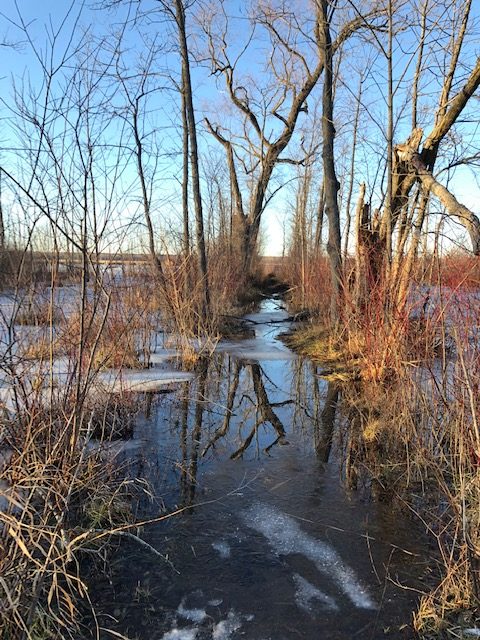
Tiny Section Side Trail Flooding

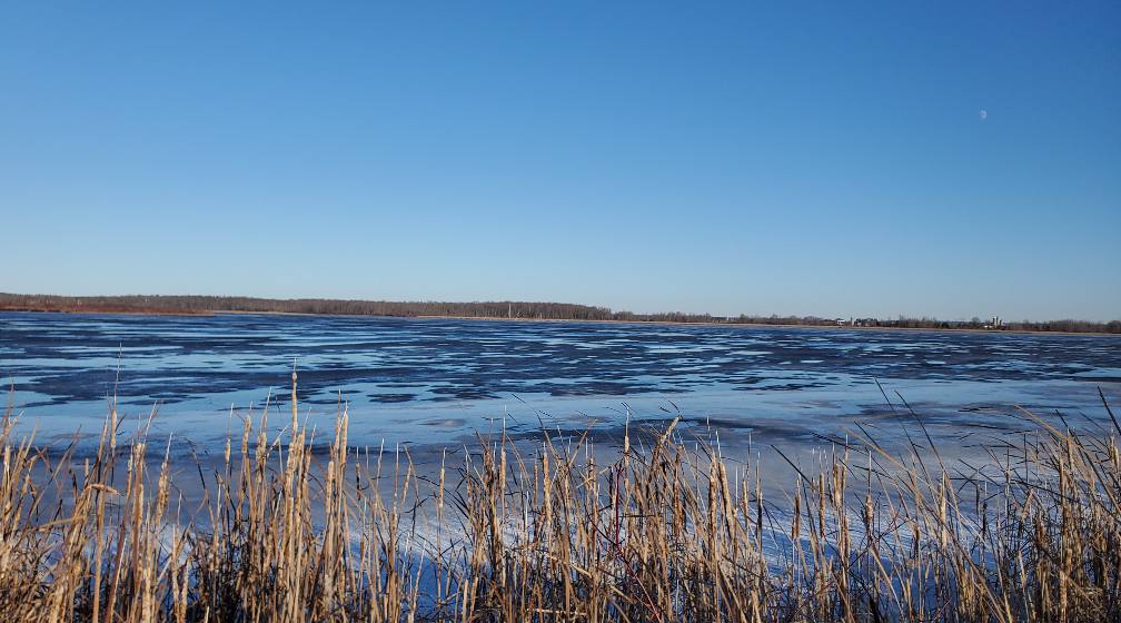
The Midland Ganaraska Hiking Club reports that unfortunately the western blue-blazed side trail loop of the Ganaraska Hiking Trail is currently under water. There is no access to the lookout tower or the boardwalk until the water recedes. As an alternate trail, go east of the Visitor Centre, and complete the 6 km loop along the Carolina and Trotter Dykes, and enjoy the beautiful view along the way.

Side Trail Under Water
View from the Dyke
View from the Dyke