Ice Storm Updates – GHTA hiking trail ice storm damage status reports can be found on our News section.
The Ganaraska Hiking Trail Association Inc. offers two tools for navigating the trail; the Ondago app for mobile devices, and a Trail Guide with detailed maps and trail descriptions, posted below on this page.
Note: In addition you can access our new interactive “Map App“! It’s free and works on any computer or mobile device with Internet or cell coverage. Click on the “i” in the top-right corner for easy instructions once loaded.
Ondago is a free mobile app available for iOS or Android phones which enables the user to download maps covering the Ganaraska Hiking Trail to their mobile device. Hikers can then use their device’s GPS to locate their position on the appropriate map, without a network connection, Wi-Fi or data usage. In addition, the maps display useful navigational information on the trail system – parking, points of interest and cautions. The app also allows individuals to share their location with others when they have network access. The app uses WGS84 as its datum and gives waypoints in latitude and longitude in decimal degrees.
The new Trail Guide, maps of which are posted below, contains trail descriptions that show kilometre markings, parking locations and the geographic coordinates in latitude and longitude in decimal degrees for each.
This Trail Guide also includes 33 PDF maps covering each Section of the Ganaraska Hiking Trail. They are numbered from Port Hope (Map 1) northward and will print in landscape format on 216mm x 270mm (8.5 X 11”) paper when downloaded.
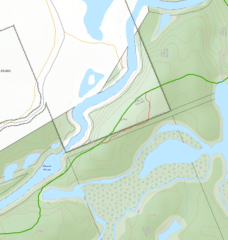
Each Trail Guide map has a legend and kilometre markings that coincides with the key trail descriptions. The Parking Lots shown on the maps display the latitude and longitude readings for their location in decimal degrees. The maps also show kilometre readings from the start of each Section. The map scale is 1:50,000 (2 centimetres = 1 kilometre). The contours are based on 10 metre intervals.
WGS84 is used as the datum on all the Trail Guide maps so GPS units will need to be set accordingly. GPS units with “built-in” maps should use the unit’s map datum unless our maps have been downloaded to their units in which case WGS84 should be used.
All bearings taken from the Trail Guide maps are in true degrees so will have to be converted to magnetic when using a compass on the ground. A true bearing is converted to a magnetic bearing by adding the declination to the true bearing when the declination is westerly. The appropriate declination is shown on each map. When converting from a magnetic bearing taken by a compass to a true bearing where the local variation is westerly, subtract the declination.
A printable Wall Map of the complete Ganaraska Trail is now available. Approximately 83cm x 58cm it’s best printed on photo paper at a print shop. There are two versions Complete GHTA Map without sections. For detailed printing instructions click here.
Trail Updates
Route changes happen regularly and are reported below, and also under the News page on this website as Trail Changes. This Trail Guide is updated as changes occur.
Each Map and Guide has an effective date and is the latest published version. It is the responsibility of the hiker to verify that the map they have downloaded or printed previously matches the latest version, as shown in the right-hand bottom corner of the map.
WHEN OUT ON THE TRAIL – WHENEVER YOU ARE IN DOUBT – ALWAYS FOLLOW THE BLAZES.
Note: The Trail Sections below are listed alphabetically. The map numbers are organized from South to North along the trail, as shown on the Index Map above.

Barrie
The Barrie section starts at the Sugarbush Estate and then runs west and north crossing Horseshoe Valley Road on the 5th line. Here it enters the Copeland Forest emerging again onto Horseshoe Valley Road, where the trail turns right and continues through Craighurst to Old 2nd South. Entering extensive bush, the trail runs west and south emerging at Gill Road and then continues through county forests to Midhurst. From here the trail goes west crossing Hwy 27 & 26, skirts the southern edge of Springwater Provincial Park and on to Snow Valley Road. The trail then goes north on Vespra Valley Road, and picks up the North Simcoe Railtrail in a southwesterly direction. It enters the forest at Pine Grove Road, passing along the southern edge of Minesing Swamp to Hwy. 90 (50.6 kms). The terrain is varied with some short, steep hills but is suitable for novices. Please note that some areas of the Minesing Swamp can be very wet.
Barrie/Orillia/Oro-Medonte Map 21 Barrie Map 22
Kawartha
The Kawartha section is almost entirely in the City of Kawartha Lakes. This section starts on the rail trail, where it intersects with Crosswinds Road, south of Reaboro. It follows the rail trail to Lindsay, then follows the Scugog River for some distance and then takes the Victoria County Recreational corridor, which it follows for two kilometres past Burnt River. At this point, there is increasing evidence of the Canadian Shield country. The section ends in Moore Falls after 77.5 kilometres of very varied terrain. The first 50 kilometres are flat, and skirts through the Kawartha Lakes. The next 20 kilometres are rugged, in shield country. The last five kilometres are again on country paths, from Buller Road to Moore Falls. This section is suitable for novices.
See Trail Changes article 2025.09.03 – Kawartha Trail Still Affected by Ice Storm
Kawartha Map 5 Kawartha Map 6 Kawartha Map 7
Kawartha Map 8 Kawartha Map 9 Kawartha Map 10
Kawartha Map 11 Kawartha Map 12
Mad River
Mad River Section has a 50.5 km section of trail that runs more or less west through Angus and Glencairn. The trail follows the Mad River in the direction of Creemore and Glen Huron, where the Ganaraska Trail meets the Bruce Trail. For more information, visit the Mad River Facebook Page.
Mad River Trail Section notice: Some Ganaraska Trail blazes have been vandalized and hikers will need to refer to the Ondago App for trail location. The small section of trail impacted is located south of the Village of Glen Huron and runs east from Concession 8 Nottawasaga Road (formerly County 62 Road) alongside a corn field and an apple orchard up to the forest edge.
See Trail Changes article 2023.10.12 – Work Begins to Develop Rail Trail Between Stayner and Angus (Mad River Club Trail)
Mad River Map 24 Mad River Map 25 Mad River Map 26
Midland
The Midland section of the Ganaraska Hiking Trail runs northward from the Oro-Medonte section and is approximately 28.2 km long. The Midland section starts just north of Vasey Road (in Tay Township) at Reeves Road and ends on Overhead Bridge Road in Penetanguishene. The trail consists of mostly undulating terrain, and mostly off-road. From Vasey & Reeves Road, it follows a fence line going north, then veers to the west via an abandoned railway line (now owned by the local Georgian Bay Snowriders Club). At Highway 12 it follows the paved Tay Shore Trail, owned by the Township of Tay, or the dirt path adjacent to it, which is referred to as the Twinning Trail. After crossing the Wye River at Sainte Marie Among the Hurons and the Martyrs’ Shrine, the Ganaraska Hiking Trail follows the Midland Rotary Waterfront Trail and ascends to Penetanguishene via the Mid Pen Trail. After a short hike through Penetanguishene via a quiet road and along a sidewalk, the trail winds through the Thompson Forest to the junction with the Tiny section of the Ganaraska Hiking Trail at Overhead Bridge Road.
Midland/Tiny Map 31 Midland Map 32
Orillia
The Orillia section starts in Sadowa at the easterly end and ends after 69 kilometres at the westerly end near the Sugarbush Estate, south of Horseshoe Valley Road, about 10 km east of Highway 400. From Sadowa to Atherley the trail is primarily on country roads, mostly quiet, peaceful and scenic. The trail skirts the shore of Lake Couchiching and runs along the Lightfoot Trail (rail trail) system through the City of Orillia where it runs south on the Mariposa Trail to Woodland Avenue. It then runs northwest along Woodland Avenue to Memorial Avenue, then southwest crossing Highway 11 at Forest Home. The trail runs through Scout Valley, a municipal park on the west side of Highway 11. It then runs east along Old Barrie Road to Rugby, then north on Oro-Medonte Line 12, remaining on fields and in woods except for a brief 1km diversion from Line 10 to Line 9 along Old Barrie Road. Overall, the trail is mostly flat and presents a variety of hiking locales, from lakeside parks to rural woodlands.
Orillia Map 16 Orillia Map 17 Orillia Map 18
Orillia Map 19 Orillia Map 20 Barrie/Orillia/Oro-Medonte Map 21
Oro-Medonte
The Oro-Medonte section starts from the main trail in the middle of the Copeland Forest at km 7.5 of the Barrie Section. It branches off and heads north, crossing Highway 400 and continues a short distance north to the Vasey Road intersection.
See Trail Changes for detour info published on May 7, 2022.
Barrie/Orillia/Oro-Medonte Map 21
Pine Ridge
The Pine Ridge section starts at the cairn opposite the Town Hall in Port Hope, beside the Ganaraska River and within sight of Lake Ontario. The section ends west of Omemee, after some 65.1 kilometres of varied terrain. The initial part is fairly flat, following the Ganaraska River. Be sure to see the fish ladder that allows fish to bypass the dam, near Highway 401. Then the trail follows country roads and paths through farmland and the Ganaraska Forest and skirts the Peterborough Drumlin field. See the Trail Description for winter detour information.
The section is easy and novices should have no difficulties. For more information, visit the Pine Ridge Hiking Club web page.
Pine Ridge Map 1 Pine Ridge Map 2 Pine Ridge Map 3
Pine Ridge Map 4 Pine Ridge Map 5
Tiny
The Tiny section of the Ganaraska Hiking Trail runs southward from Overhead Bridge Road in Penetanguishene to Wasaga Beach and is approximately 30.4 km long. The Tiny section descends through the Thompson Forest to the Tiny Trail (a rail trail owned and operated by the Township of Tiny) and through the village of Wyevale to just south of Tiny Conc. 2, where the Ganaraska Hiking Trail leaves the rail trail, turns north for 200 m on County Road 6 and then west on Tiny Conc. 2 towards the Tiny Marsh. In combination with the Ganaraska Hiking Trail, you can hike a great 8-9 km consisting of 2 loops on the Tiny Marsh dikes. The Ganaraska Hiking Trail continues westward past the Tiny Marsh Visitor Centre on the Tiny/Flos Townline to Tiny Beaches Road where the Tiny section connects with the Wasaga Beach section, near Allenwood Beach.
Tiny Map 29 Tiny Map 30 Midland/Tiny Map 31
Wasaga Beach
The Wasaga Beach section begins just south of Archer Road on River Road East. The trail winds through the fragile ancient parabolic sand dunes of Wasaga Beach Provincial Park to Wasaga Beach, providing great views of the Nottawasaga River deep below in the valley. From there, the trail goes through the valley of the McIntyre Creek and passes along quiet country roads to Smithdale, east of Glen Huron, where it connects with the Mad River section. The section is about 48.5 kilometres long and is suitable for novices.
Wasaga Beach Map 26 Wasaga Beach Map 27
Wasaga Beach Map 28 Wasaga Beach Map 29
Wasaga Beach Trail Description
Wilderness
The Wilderness Section is approximately 71.5 kilometres long. As well as being scenic, it is rugged and challenging. It is strongly recommended that the Wilderness Section only be hiked with an experienced hiker familiar with the Trail. For more information, visit the Wilderness Facebook Page.
Wilderness Map 12 Wilderness Map 13 Wilderness Map 14
Wilderness Map 15 Wilderness Map 16
If you plan to hike in the QEII Provincial Park, the most up to date mapping can be found here
https://www.ontarioparks.
Reminder re parking at Moore Falls: please park in the open grassy area to the left of the trail off Country Rd. just west of Hwy 35. No parking at km 1.1, where the trail leaves Black Lake Cottage Rd. to enter the woods. And definitely no parking at the Black Lake Cottage Rd. parking area.
Effective May 2011, the Wilderness Trail has been rerouted at km1.1, where the trail turns right off Black Lake Cottage Rd. It reconnects with the old trail after approximately 1km. The reroute adds approximately 350 metres to the trail. Please follow the new blazes and stay on the trail. Do not walk on the private cottage laneway immediately next to the reroute.
Effective May 2018, there is a Ragged Rapids Loop Trail 500m re-route, approx. 1.5 km from Victoria Bridge. Notice that part of the trail crosses over private property, as is the case in a number of locations. Please respect private property.
Wilderness Map 14 Ragged Rapids Loop Trail Re-Route
Effective October 6, 2021 west of North Smudge Lake near campsite 12, a number of beaver dams including one that is part of the Ganaraska Trail have blown out recently. Please follow the temporary reroute (not flagged) to a beaver dam that is still standing. The reroute is 1.2 km, adding .5 km to the total distance of the trail.
Montgomery Creek Floating Bridge Seasonal Removal
Each fall, the bridge segments are disconnected and heaved up onto the bank to keep them high & dry over the winter season. After the bridge is out, we can still cross safely on the fallen tree (aka the “Four Brothers”) that spans Montgomery Creek about 250 metres upstream from the private bridge. The bridge is replaced in the spring.